
An Mam [Maum]
Good walks are even better shared.
Overview
An Mam [Maum] - The Hidden Gem of Connemara
An Mam, standing proudly at 631 meters, is a lesser-known treasure within the Twelve Bens mountain range in Connemara. With a prominence of 50 meters, it might not be the tallest peak around, but it certainly packs a punch when it comes to views!
Geology
The geological marvel of An Mam is something to behold, primarily crafted from sedimentary rocks including sandstone and shale. These give it a unique ruggedness, and keep an eye out for patches of quartzite that shine like diamonds in the rough!
Routes
Bencorr and An Mam Loop
This route is perfect for those who love to immerse themselves in both beauty and a bit of a workout. Expect a scenic 12 km loop that takes about 4 hours. The views are absolutely worth it, trust us!
Direct Ascent from Lough Inagh
Feeling adventurous? This challenging 6 km route directly from Lough Inagh will bring you to the summit in around 2.5 hours. It’s a straightforward path, but do keep your wits about you!
Summit Features
Upon reaching the cairn at the summit, you’ll be greeted by breathtaking panoramic views of the Twelve Bens and shimmering loughs below, just begging for a postcard opportunity!
Terrain Type
Prepare yourself for a mixed bag. Expect rocky paths interspersed with some boggy patches that may tempt muddy mischief!
Views
On a clear day, you can witness the magnificent vistas stretching across the Twelve Bens, Lough Inagh, and beyond. Spring and Summer promise the best views, but Autumn's riot of colours is equally enthralling. Settle in with a good book, and let the beauty seep in!
Hazards
Do watch for those capricious Connemara weather patterns, which can shift quicker than you can say 'Irish rain'. Also, those sneaky bogs can pull a fast one on unsuspecting feet!
Nearby Summits
If you’re up for it, why not tackle nearby Bencorr (787 meters) or the Maumturks (849 meters) for some added adventure?
Access
Nearest Parking
Lough Inagh Lodge is your go-to for parking; just be warned, it can fill up faster than a pub on a Friday night!
Public Transport
Public transport connects let you arrive without a hitch. Buses run from Galway to Clifden, linking you to Lough Inagh.
Nearest Town
Recess, the nearest town, is about 12 km to the south and is a charm in itself.
Facilities
Lough Inagh Lodge promises some hearty grub and clean facilities, while Recess has small shops and cafes if you're looking to stock up.
History
Name Meaning
The name 'An Mam' translates to 'The Plain', reflecting the serene landscape surrounds.
Significance
Not only is it a natural beauty but it’s steeped in traditional Gaelic folklore, adding a dash of magic to your adventure.
So there you have it! An Mam is an enchanting experience just waiting for your hiking boots!
Explore routes near An Mam [Maum]
Public walks starting within 80 km of this hill. Nearby does not mean a route reaches the summit; check its map and access before setting out.
Route planning notes
These notes describe possible approaches, not verified navigable routes or permission to cross land. Check current paths, local access rules and conditions before setting out.
Bencorr and An Mam Loop
A scenic loop that offers a solid workout with stunning views and a delightful traverse over Bencorr before summiting An Mam.
Direct Ascent from Lough Inagh
A straightforward path leading from Lough Inagh, perfect for those who want to tackle An Mam head-on.
Make a day of it, together
Find someone to share the walk with, or organise a day out along a route you like.
Hill facts and local notes
Classifications
Elevation
325m
1,066 ft
Prominence
141m
Coordinates
54.7505, -8.5412
G652893
OS Map
10
At the Summit
The summit features a modest cairn, perfect for a celebratory photo, as well as expansive views across the Twelve Bens range and Loughs Inagh and Beagh.
Terrain & Geology
An Mam is primarily composed of sedimentary rocks, primarily sandstone and shale, which gives it a rugged charm typical of the Connemara area. Be prepared for the occasional surprise when you stumble upon a patch of quartzite!
Views & Scenery
On a clear day, gaze upon the magnificent peaks of the Twelve Bens, the vast expanse of Connemara, and the shimmering waters of nearby loughs.
History & Heritage
Name Origin
The name 'An Mam' translates to 'The Plain' in Irish, reflecting the surrounding flatlands and beauty.
Historical Significance
Historically significant for both its natural beauty and as part of traditional Gaelic folklore.
Getting There & Facilities
Check current local access restrictions, parking rules and transport timetables before travelling. These notes do not confirm public access to the summit.
Parking
Lough Inagh Lodge offers parking, but spots can fill up quickly during peak seasons.
Public Transport
Bus service operates from Galway to Clifden, with connections to Lough Inagh area. Plan ahead!
Nearby Facilities
Lough Inagh Lodge provides food and restroom facilities; the nearby town of Recess has small shops and cafes.
Safety Information
Known Hazards
- Beware of sudden weather changes, as well as boggy patches that can catch even the most careful of hikers off guard.
General Safety Tips
- Check weather conditions before setting out
- Carry appropriate clothing and equipment
- Let someone know your planned route
- Take a map, compass, and GPS device
- Carry emergency supplies: food, water, first aid kit, torch
Hills
Some common questions about the hills answered
Are there group walks up An Mam [Maum]?
Many walkers use Walkmates to join or organise walks with others. You can check for group walks around An Mam [Maum] through the maps
Are there other walkers around An Mam [Maum]?
Activity varies by location and time, but Walkmates lets you see whether others have shared walks or shown interest in this area. Find other people through the walking friends search walking friends for An Mam [Maum] search or of course create your own walk for An Mam [Maum]
Can I organise a walk to An Mam [Maum]?
Yes. If there aren’t any walks listed already, you can create a walk and make it available for others to join.
If you're signed up to Walkmates, you can create a walk to An Mam [Maum].
How do I find a walk up this hill?
There are often multiple ways to walk this hill, depending on experience and route preference. Walkmates helps you explore walks and routes that others have shared.
Can I suggest a new route up An Mam [Maum]?
Yes. You can suggest or create routes to share with others. Walkmates focuses on the social side of walking, so routes are used to help people organise walks and explore areas together, rather than as detailed navigation tools or route libraries.
Other uses really appreciate knowledgeable walkers sharing their routes. Share your favourite route to An Mam [Maum] here
The is an error or something incorrect about this hill. How do I let you know?
We always strive to keep the information on Walkmates as accurate as possible. If you find an error, please let us know through the contact form and we'll aim to correct it as quickly as possible
Community Discussion
Comments
Location
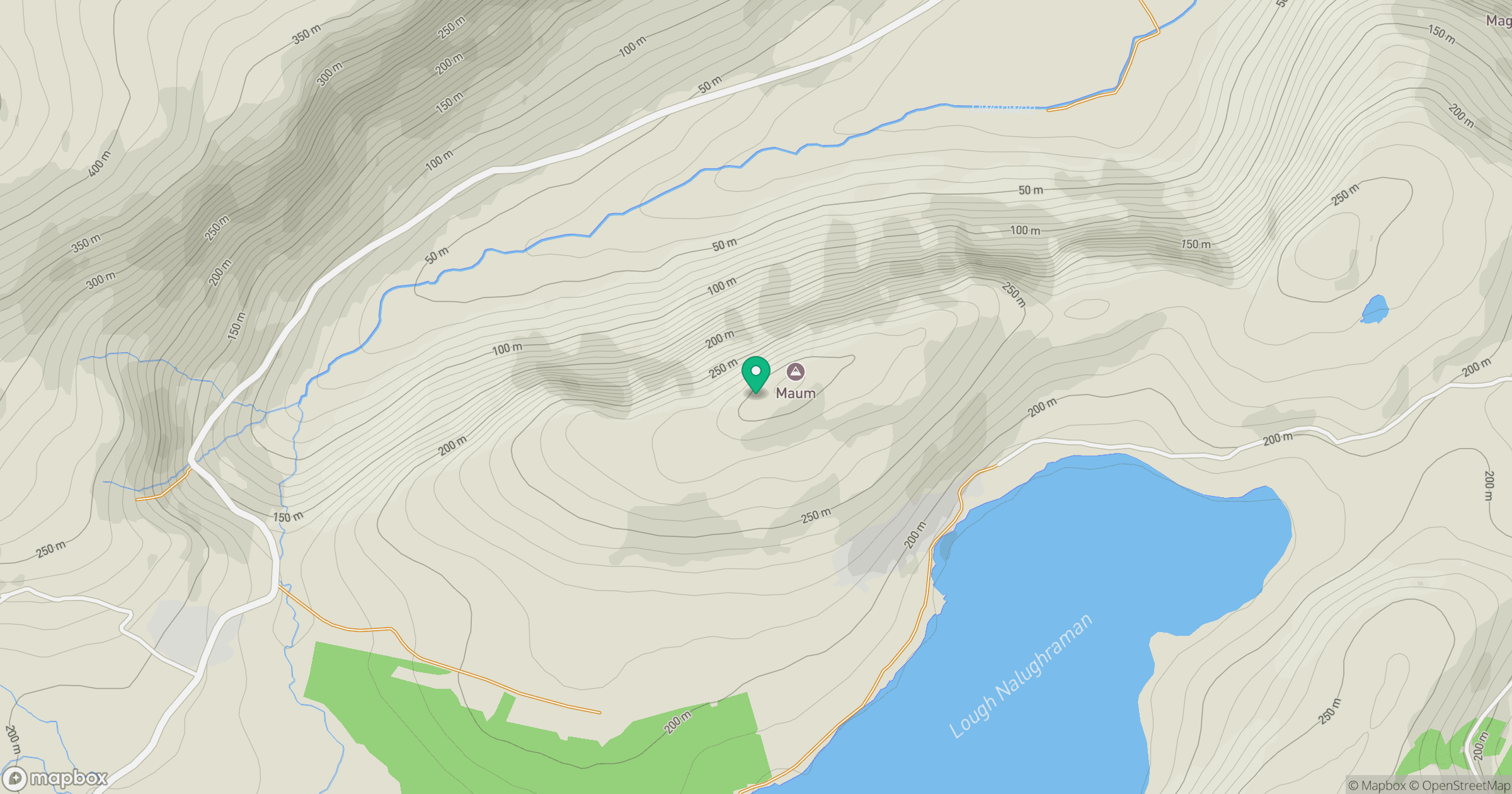
Grid reference: G652893
View on OpenStreetMapOpens a map in a new tab, centred on the hill.
Hills within 30 km
Straight-line distance, not a walking route or confirmation of access.
No comments yet. Be the first.